

Our Day 6 adventures continued with a drive into Cumbria in northern England to see Hadrain’s Wall. This area was once the edge of the Roman Empire and the wall was built by the Roman emperor Hadrian. Theories vary as to why the wall was built – defense, immigration & customs or just a show of power, but the fact that portions of it remain today is a lasting testament to their strength. The wall extended over 70 miles at it’s completion with garrison towers along it’s length. The first area we stopped at still had the foundations of one of these towers.

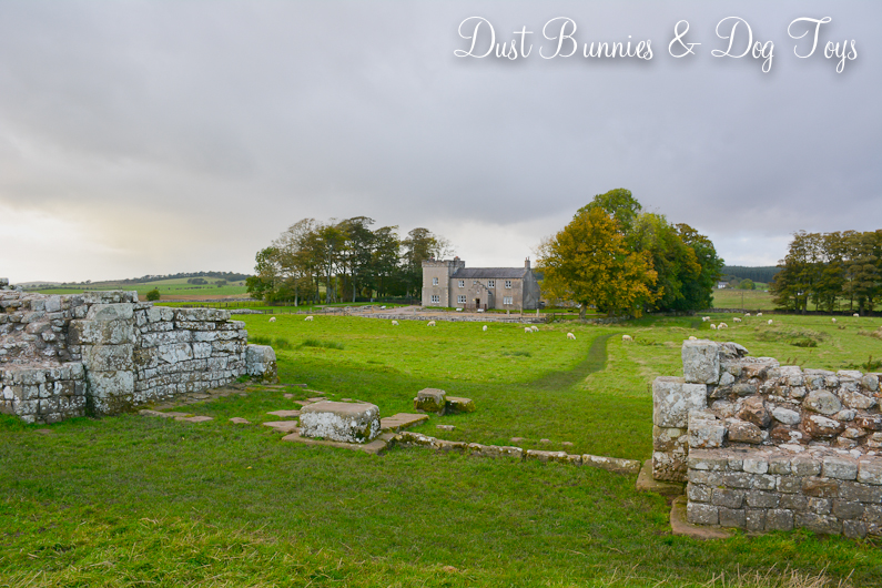
The view from the location was stunning and strategic. Today the wall is surrounded by fields of grazing livestock, which belie the tumultuous history of the region.

The thickness of the walls was impressive, especially when you consider that they were created by hand without modern machinery. Many areas of the wall have been robbed of their stones over the centuries as new structures were built in the region.
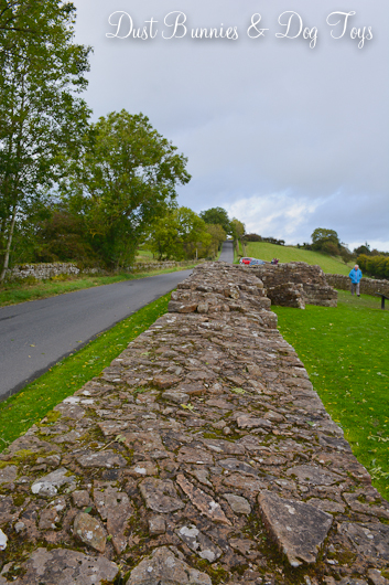
Today’s roadway follows alongside the wall in many places. Here the local vegetation has created an archway bridging today and the past in another way.

We continued up the road to a visitor center at a key point along the wall. This spot was the location of the Birdoswald fort where regiments would have been stationed and trained. Today it is the longest surviving stretch of the wall.


At the heart of the fort’s footprint is a house constructed centuries after the empire fell during the Victorian era. The house and estate were purchased during the 1840’s by Henry Norman, who had a strong interest in the fort and it’s history. He was the first person to employ archaeologist to conduct excavations on the site. He added the tower and porch to the farmhouse to give it a medieval style as was fashionable at the time.

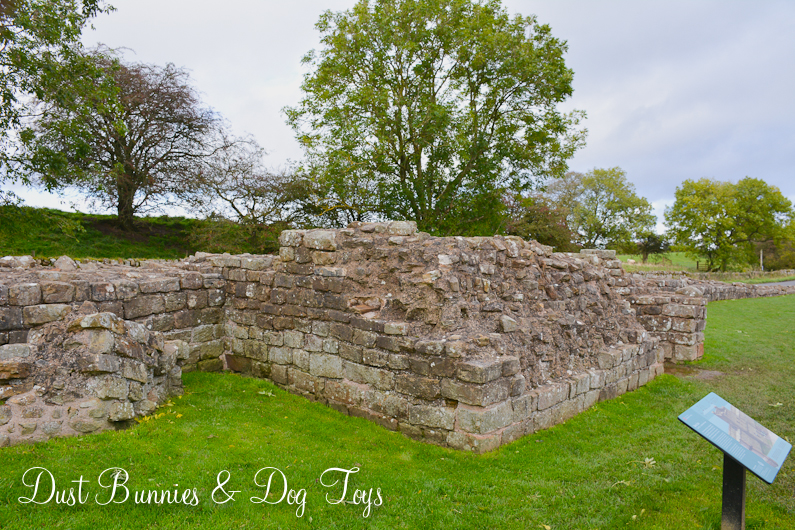
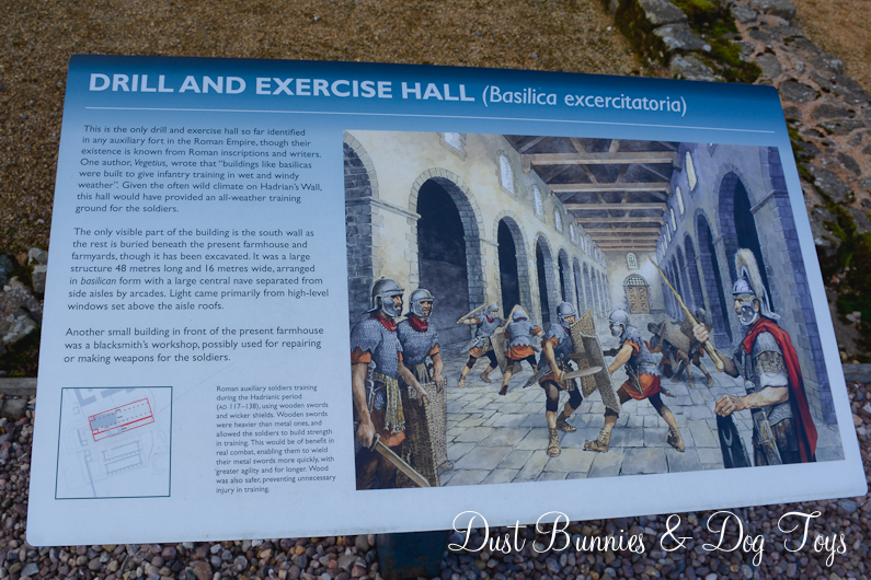
Beneath the lawn of the house were the foundations of several of the fort’s key buildings, including the granaries and garrison hall where the soldiers would train. The excavated foundations of these structures are marked out with posts today.


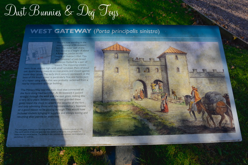
From the house you can see where the fort gates had been in the distance. Signage shows what they would have looked like when it was at it’s height of use during the Roman occupation.

Because we arrived late in the day the fort was closing shortly after we arrived, so we saw what we could and then headed back the way we had come to check out a cool looking spot I’d seen on the way in. This stone archway marked the entrance to the area, which turned out to be Lanercoast Priory, an ancient monastery.

Due to the time of day, everything at the site was closed so we enjoyed touring the grounds instead. The east end of the church is still functioning and was under restoration near the entrance.

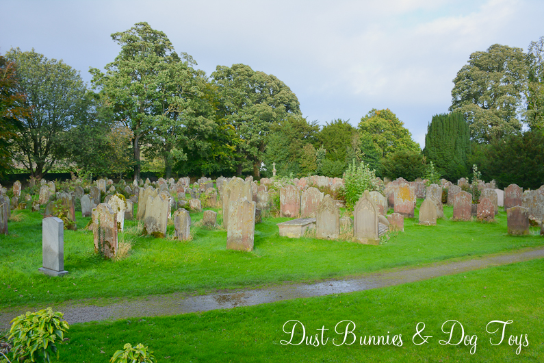
I discovered these stone steps along the wall coming off the church and decided to explore. Beyond the wall was an ancient cemetery with rows and rows of aged headstones. Some were washed plain by the elements, while others retained their medieval style.


From the cemetery you can see the damaged section of the priory, which has been left open. The structure is massive and absolutely stunning from every angle.


We walked around the building to the other side where we had a fuller view of the entire complex, including foundations of areas that no longer stand.

Beyond this fence was yet another field of grazing sheep, completely oblivious to the history and beauty that surrounded them.

We headed back toward our vehicle at the front of the church where there were a few smaller buildings that looked like row houses. I felt like I’d stepped into the pages of a storybook and had been transported back in time.


The signage nearby gave an aerial view of the buildings and described how it had been converted to a grand residence after the Reformation.

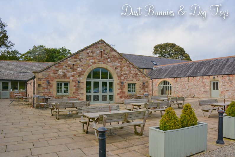
On the other side of the estate was a shop and tea room, which were also closed. I was pretty bummed and wished we’d stopped here first before going up to Birdoswald so I could have browsed their wares. What I could see through the windows certainly looked like my style! There was also an outdoor eating area that I’m sure is fantastic to enjoy during the warmer months.

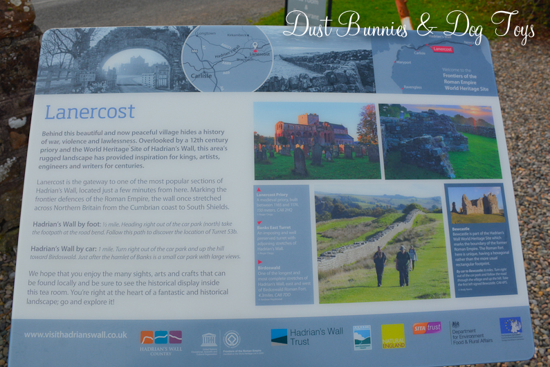
Signs in front of the shop described local sights and history. As I wandered past the outdoor eating area along the parking lot I spotted this pretty little alley way which continued the storybook look.

On the far side of the parking lot was a large stone home, which I discovered was a B&B. It too was closed but it was still lovely to see from the outside.

With the light fading we made our way back toward Edinburgh for the night. Along the way we enjoyed several European road signs we spotted, which created a few chuckles about how different they were from American road signs and yet so similar.


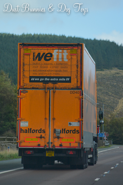
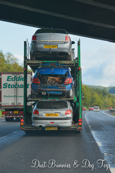
We also had fun noticing the different truck rigs, which included extra tall loads, rounded top trailers and a triple-decker car hauler!

Because the Hubs has an American CDL we had been noticing the differences in rigs here the entire trip, along with how they handle the narrow roads and tight quarters. On several occasions we spotted trucks stopped on the wrong side of the road unloading, but this one we spotted on the way into Cumbria was actually disconnected and LEFT on the road. The local drivers seemed used to this behavior and just made their way around the obstacle as they could but we certainly got a big chuckle out of it and had a lively conversation about how that would never happen in the US.

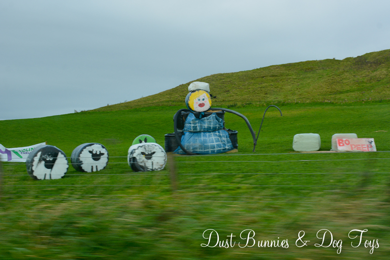
We also spotted several fun displays along the highways including this hay bale Bo Peep and her sheep!
 It had been a long but wonderful day and we were ready to rest when we reached Edinburgh. We had one day left and were going to make the most of it playing tourist with a trip into the heart of the city.
Check out our other Scotland adventures:
And our travels through Iceland on the same trip with Day 1, Day 2, Day 3 and Day 4.
